Permanent station of Paularo
[Paul]

| City | Paularo (UD) |
| Address |
stazione forestale building
strada di Val, 15/A - 33027 |


Real-time data are temporarily unavailable

Coordinates
| Latitude | 46°32'07,5958'' |
| Longitude | 13°06'57,3563'' |
| North | 5155266.054 |
| East | 355527.256 |
| Fuso | 33 |
| Latitude | 46°32'07.5954'' |
| Longitude | 13°06'57.3555'' |
| North | 5155266.041 |
| East | 355527.239 |
| Zone | 33 |
| Latitude | 46°32'05.1947'' |
| Longitude | 0°39'49.5393'' |
| North | 5155290.031 |
| East | 2375531.138 |
| Zone | EST |
| Ellipsoidal elevation (m) | 741.789 |
| Orthometric elevation (m) | 692.788 |
Satellites
|
|
|
|
|
|
Instrumentation
| ARP | BAM |
| ARP Up Ecc | 0.0350 m |
| ARP North Ecc | 0.0000 m |
| ARP East Ecc | 0.0000 m |
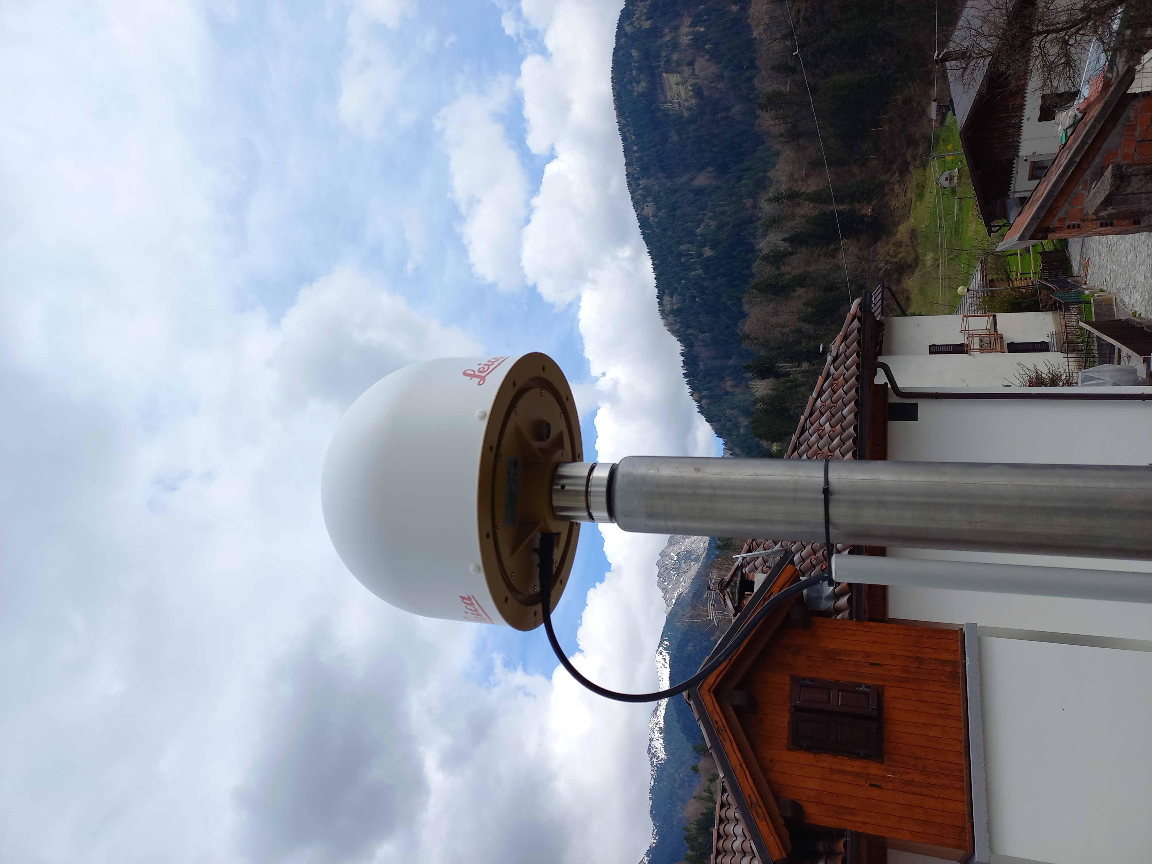
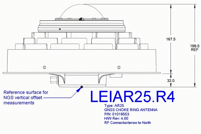
ANTENNA: Leica AR25 with Spherical Dome (LEIAR25.R4)
Serial Number:
727614
Antenna Reference Point:
BAM
Antenna Radome Type:
LEIT
Antenna Cable Length:
-
Date installed:
04/04/2024
RECEIVER: Leica GR50
Serial Number:
2092018
Satellite System:
GPS+GLO+GAL+BDS
Firmware Version:
4.70/7.813
Elevation Cutoff Setting:
5
Date installed:
04/04/2024