Permanent station of Gorizia
[Gori]

| City | Gorizia (GO) |
| Address |
regional building
via Roma, 7 - 34170 |


Real-time data are temporarily unavailable

Coordinates
| Latitude | 45°56'35,8798'' |
| Longitude | 13°37'25,7187'' |
| North | 5088668.480 |
| East | 393330.011 |
| Fuso | 33 |
| Latitude | 45°56'35.8784'' |
| Longitude | 13°37'25.7185'' |
| North | 5088668.437 |
| East | 393330.005 |
| Zone | 33 |
| Latitude | 45°56'33.5167'' |
| Longitude | 1°10'17.8600'' |
| North | 5088691.518 |
| East | 2413335.427 |
| Zone | EST |
| Ellipsoidal elevation (m) | 153.407 |
| Orthometric elevation (m) | 108.312 |
Satellites
|
|
|
|
|
|
Instrumentation
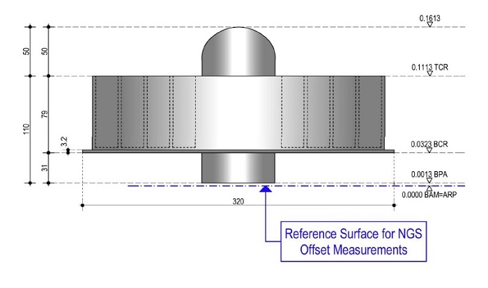
| ARP | BAM |
| ARP Up Ecc | 0.0000 m |
| ARP North Ecc | 0.0000 m |
| ARP East Ecc | 0.0000 m |
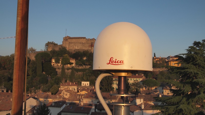
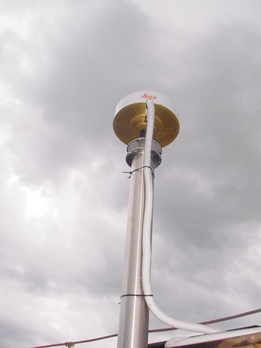
ANTENNA: Leica AR20 with Dome (LEIAR20)
Serial Number:
16072010
Antenna Reference Point:
BAM
Antenna Radome Type:
LEIM
Antenna Cable Length:
15
Date installed:
12/04/2013
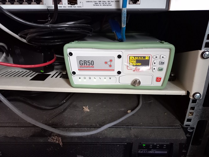
RECEIVER: Leica GR50
Serial Number:
2092021
Satellite System:
GPS+GLO+GAL+BDS
Firmware Version:
4.70/7.813
Elevation Cutoff Setting:
5
Date installed:
06/02/2024