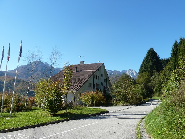
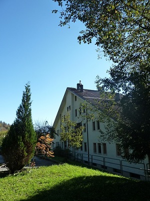
Permanent station of Barcis
[Barc]

| City | Barcis (PN) |
| Address |
stazione forestale building
località Roppe, 25 - 33080 |


Real-time data are temporarily unavailable

Coordinates
| Latitude | 46°11'35,1481'' |
| Longitude | 12°33'49,0167'' |
| North | 5118387.660 |
| East | 312004.751 |
| Fuso | 33 |
| Latitude | 46°11'35.1473'' |
| Longitude | 12°33'49.0161'' |
| North | 5118387.636 |
| East | 312004.738 |
| Zone | 33 |
| Latitude | 46°11'32.7380'' |
| Longitude | 0°06'41.3042'' |
| North | 5118410.002 |
| East | 2332008.414 |
| Zone | EST |
| Ellipsoidal elevation (m) | 528.440 |
| Orthometric elevation (m) | 480.519 |
Satellites
|
|
|
|
|
|
Instrumentation
| ARP | BPA |
| ARP Up Ecc | 0.0000 m |
| ARP North Ecc | 0.0000 m |
| ARP East Ecc | 0.0000 m |
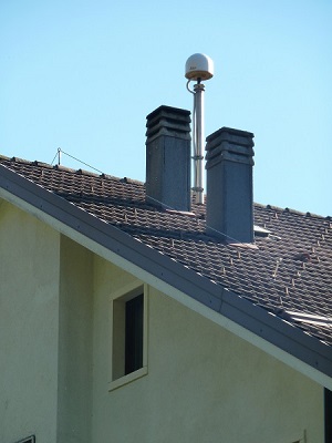
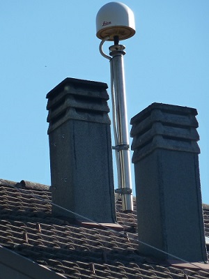
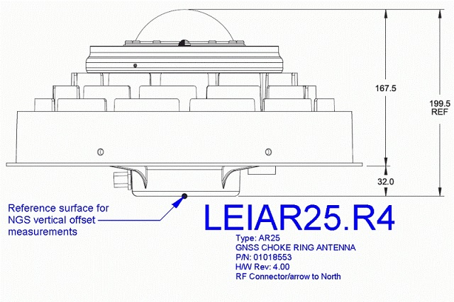
ANTENNA: Leica AR25 with Spherical Dome (LEIAR25.R4)
Serial Number:
725474
Antenna Reference Point:
BPA
Antenna Radome Type:
LEIT
Antenna Cable Length:
30
Date installed:
24/10/2012
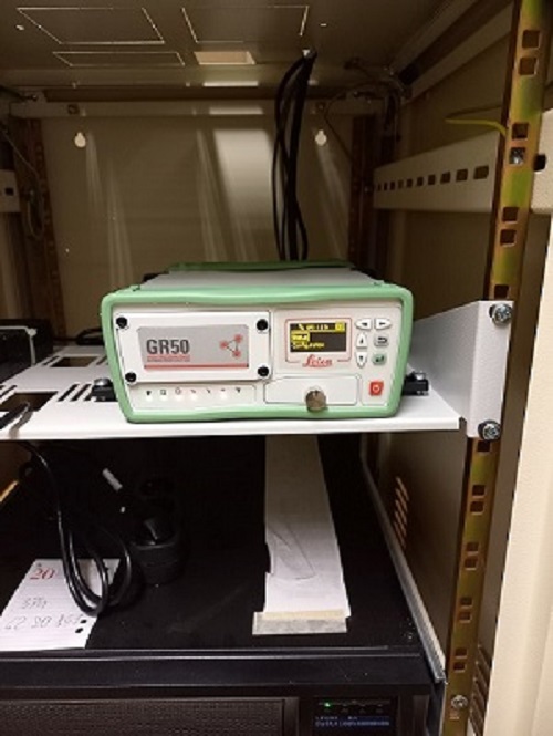
RECEIVER: Leica GR50
Serial Number:
2091634
Satellite System:
GPS+GLO+GAL+BDS
Firmware Version:
4.70/7.813
Elevation Cutoff Setting:
5
Date installed:
26/01/2024